
Independent Travel Guides — Traveller into Egypt
Independent Travel Guides for the Modern Explorer
A dedicated resource for the autonomous traveller into Egypt. Editorial looks at diverse ecosystems and historical landscapes across the northeast corner of Africa — from the northern Mediterranean fringe to the deep southern borders.
From the Mediterranean fringe to the deep southern borders.
Field Orientation
What This Portal Covers
Welcome to a dedicated resource for the autonomous traveller into Egypt. This portal offers an editorial look at the diverse ecosystems and historical landscapes found across the northeast corner of Africa. Instead of standardized holiday packages, we focus on the raw geography and cultural textures that define the region.
From the northern Mediterranean fringe to the deep southern borders, our egypt travelling guides help you navigate the terrain with local insights and practical maps. We cover fringing reefs along the Red Sea, the green bands of the Nile Valley, the limestone and sand plateaus of the western interior, and the rugged eastern mountains that separate the river from the coast.
Every section is written for independent explorers who value grounded preparation over packaged itineraries. You will find details on seasonal water temperatures, transit logistics, bird migration windows, and the social customs that shape village life. Our travel guides treat each region as a living landscape rather than a checklist of stops.
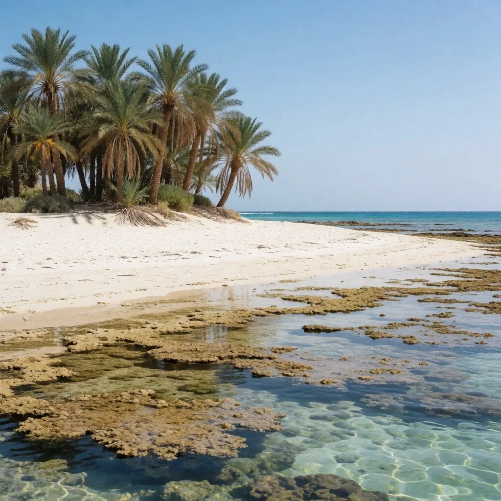
Region 01 — Eastern Coast
The Coastal Fringe and Marine Life
The eastern border of the country meets the Red Sea, a body of water known for intense clarity and high salinity. Coastal exploration here focuses on the fringing reefs and the migratory patterns of marine species. Our guides cover the quiet bays where sea grass attracts dugongs and the steep underwater walls that draw divers from around the globe.
We provide details on seasonal water temperatures and visibility conditions to assist in planning your time near the shore. The reefs sit close to the coastline in most areas, which means snorkelling access is direct from beach entries rather than boat-only sites. Winter months bring cooler water and larger pelagic visitors, while late summer offers the calmest surface conditions for shallow exploration.
Coastal Quick Facts
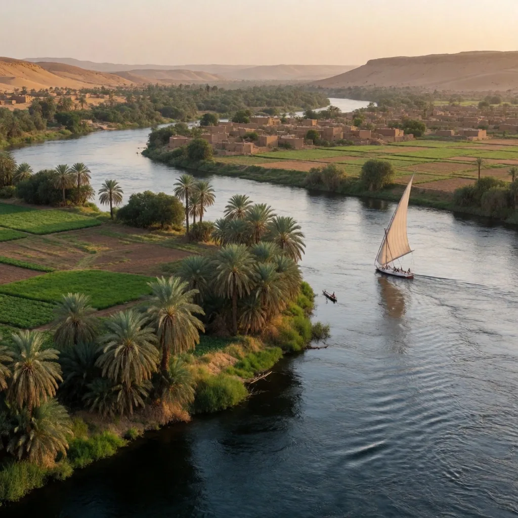
Region 02 — The Nile Valley
River Life and Agricultural Rhythms
The Nile remains the primary artery of life, carving a green path through the arid surroundings. Exploring the banks of the river offers a glimpse into traditional farming techniques that have persisted for centuries. Travelers can find information on the various stretches of the river, from the wide deltas in the north to the narrow granite gates in the south.
We detail how to observe the local flora and fauna without disrupting the delicate balance of the riverbank communities. The seasonal flooding cycle, though now regulated by upstream infrastructure, still shapes planting calendars and village routines. Sugar cane, maize, and date palms dominate the cultivated strip, while ibis and heron populations concentrate in the shallower channels.
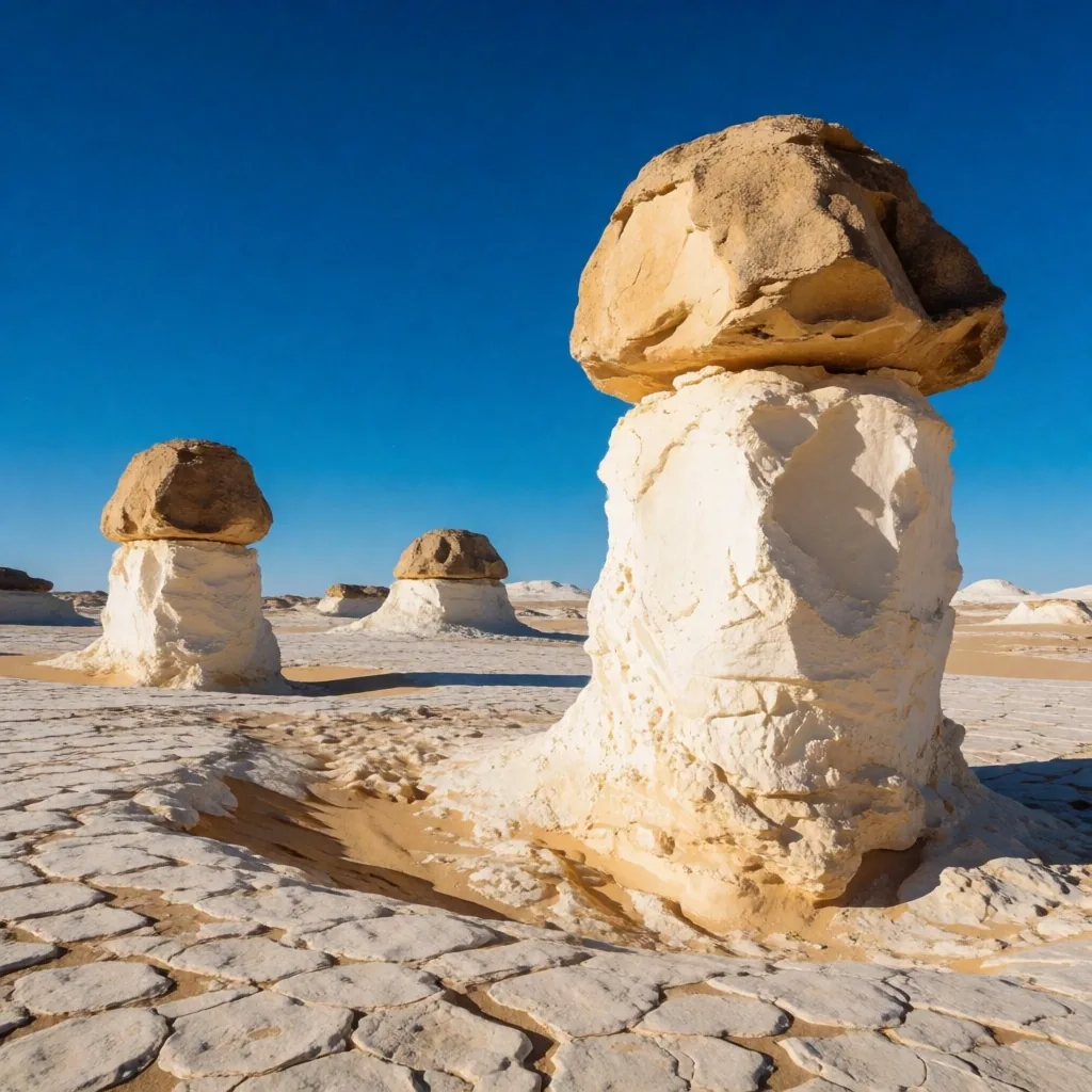
Western Formations — Limestone Plateau
Region 03 — Arid Interior
High Desert Plateaus and Dunes
Away from the water, the landscape transforms into vast stretches of limestone and sand. The western reaches are home to unique geological formations that look like snow-covered peaks, while the eastern heights offer rugged hiking opportunities. Our desert guides prioritize safety and ecological awareness.
We explain the topography of these regions so you can understand the scale and the biological adaptations of the plants and animals found in the arid interior. Water is the defining constraint. The few species that thrive here do so through deep root systems, nocturnal activity patterns, and moisture capture from morning dew. Travellers should carry sufficient supplies and avoid crossing open plateau during peak heat hours.
Open Desert RoutesRegion 04 — Valley Floor
Historical Pacing and Ruins
Ancient structures are scattered across the valley and the oases, offering a window into thousands of years of human habitation. We approach these sites as architectural and archaeological marvels rather than mere photo opportunities.
Our documentation focuses on the orientation of these structures, the materials used in their construction, and their relationship with the surrounding environment. This helps the independent explorer appreciate the scale of human history without the distractions of commercial crowds. Limestone and sandstone are the dominant building stones, sourced from nearby quarries and transported via canal branches during the seasonal flood.
Site Observation Criteria
Region 05 — Southern Border
Southern Gateways and Cultural Shift
As you move south toward the border with Sudan, the pace of life slows and the cultural influences change. The landscapes here are dominated by dark granite and the vast expanse of the southern reservoir. This area provides a different perspective on the country, where the desert meets deep blue water.
Our guides highlight the specific geography of the southern cataracts and the islands that dot the river. The granite boulders create natural rapids that historically marked the boundary of navigable water. Today, ferry crossings connect island communities to the mainland, and the reservoir's edge shifts with the seasonal drawdown cycle. Nubian architecture, with its bright geometric facades, distinguishes the villages here from the Nile Valley norm.
Compare With Other Regions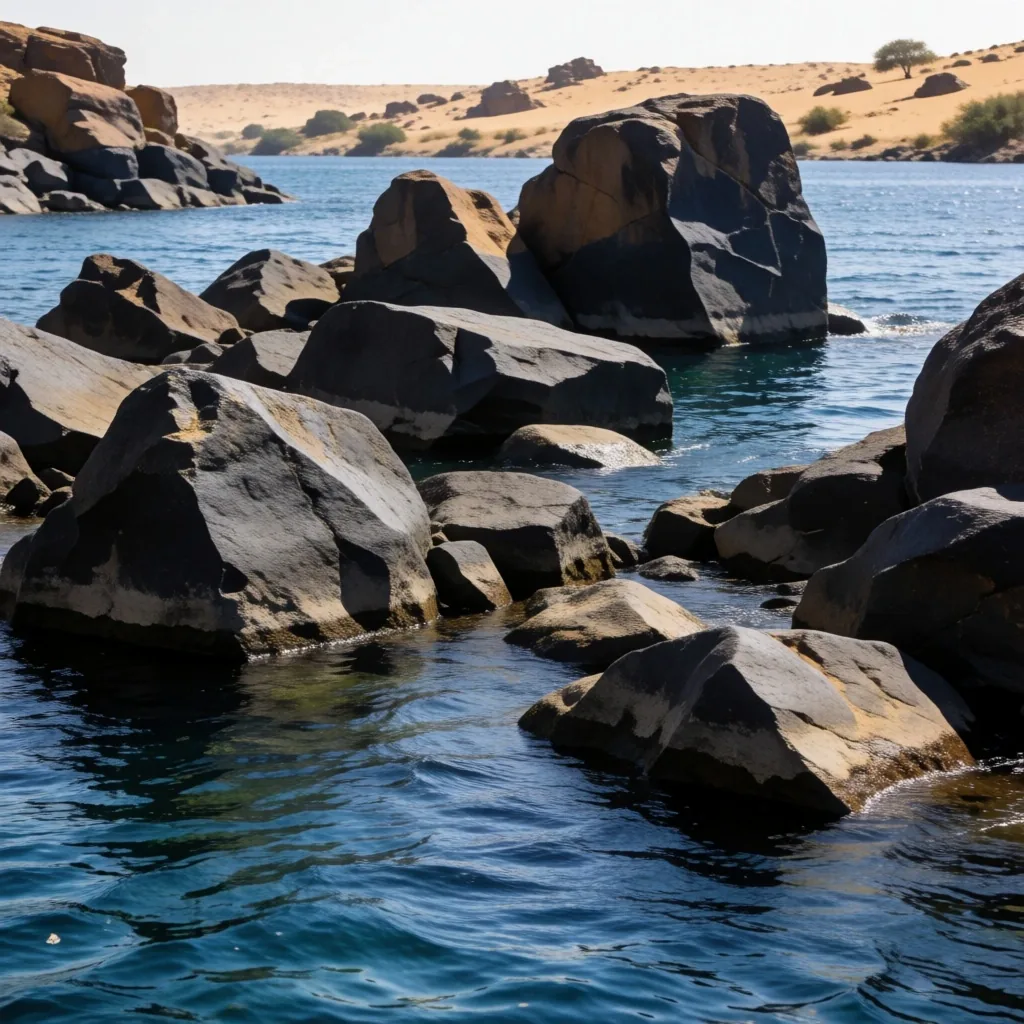
Planning Reference
Seasonal Weather Patterns for Planning
Egypt experiences significant temperature swings depending on the month and the specific microclimate. The northern coast stays relatively mild, while the southern valley can see intense heat. We break down the climatic zones to help you choose the right time for your specific interests, whether that involves trekking in the mountains or exploring coastal lagoons. Understanding the Khamsin winds and the winter cooling is essential for any traveller into Egypt.
Zone 01
Northern Coast
Mediterranean influence keeps temperatures moderate. Winters are cool and occasionally rainy. Summers are warm but rarely extreme compared to the interior.
Zone 02
Nile Valley
Hot summers with sustained daytime peaks. Winter brings cool nights and pleasant daytime exploration. Spring carries dust from the Khamsin winds.
Zone 03
Red Sea Coast
Warm year-round with low rainfall. Sea breezes moderate the heat. Summer water temperatures are ideal for extended snorkelling sessions.
Zone 04
Southern Border
The hottest zone. Summer travel is difficult. Winter is the primary exploration window, with clear skies and manageable daytime temperatures.
Regions 06 — 08
Beyond the Valley Floor
Western Interior
The Oasis Network of the West
Deep in the western interior, small pockets of green offer respite from the sun. These oases are sustained by ancient aquifers and have their own distinct customs and agricultural products. Our guides explore the connectivity between these remote outposts. We look at the history of the caravan routes and the modern roads that now link these isolated communities to the Nile Valley.
Dates, olives, and spring-fed agriculture define the local economy. Water emerges at temperatures that allow year-round cultivation, though soil salinity management remains an ongoing challenge for the farming communities.
Desert Routes →Northern Wetlands
Northern Marshes and Delta Life
The area where the Nile splits into many branches before meeting the sea is often overlooked by casual visitors. It is a region of intense agricultural activity and significant bird populations. We provide an editorial look at the lagoons and the fishing villages that define this watery landscape.
Migratory birds pause here on the African-Eurasian flyway, making the coastal lagoons some of the most productive observation sites in the country. The fishing communities operate small boats and woven traps, methods that have remained largely unchanged for generations. This section is for those interested in the environmental diversity found outside the typical desert settings.
Nile Valley Guide →Eastern Highlands
Mountainous Terrain of the East
Between the Nile and the Red Sea lies a range of rugged mountains. These peaks offer a different kind of exploration involving deep wadis and ancient mining paths. The geology here is diverse, featuring igneous and metamorphic rocks that contrast sharply with the limestone found elsewhere.
Our guides describe the major peaks and the routes that allow for a deeper understanding of the high-desert wilderness. Old mining trails, some dating back thousands of years, provide readable routes through terrain that otherwise appears impassable. Travellers should be prepared for steep elevation changes and carry detailed navigation aids.
Coastal Guide →Logistics
Connectivity and Internal Transit
Moving between regions requires a basic understanding of the national infrastructure. While we do not handle bookings, we describe the various modes of transit available to the public.
From the rail networks connecting major hubs to the small ferries used in rural areas, knowing how the locals move is key to an authentic experience. We focus on the logistical realities of traversing the distance between the Mediterranean and the Red Sea, including overnight sleeper services, long-distance bus operators, and the river ferries that serve communities without bridge access.
Community
Rural Hospitality and Customs
Engagement with local communities is a natural part of independent travel. We provide context on social norms and traditional ways of life in the villages.
Understanding the importance of tea culture and communal meals can make your interactions more meaningful. We aim to bridge the gap between the visitor and the host through cultural literacy. Accepting offered tea is a gesture of respect, and meals are typically shared from a central dish. Dressing conservatively in village settings signals awareness of local expectations.
Field Practice
Photography and Observation Ethics
Documenting your journey requires a respectful approach to both people and nature. We offer guidelines on how to photograph sensitive areas and the importance of seeking permission.
Our mission is to promote travel that leaves a minimal footprint while capturing the essence of the location. This section discusses light conditions and the best times for observing the natural landscapes. Early morning and late afternoon provide the most revealing relief on rock and sand, while overcast days suit detail work in the villages.
Region 09 — Metropolitan Centers
Urban Hubs and Historical Centers
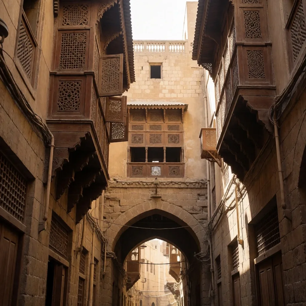
While the nature is vast, the cities serve as the heartbeat of the nation. We look at the architectural layers of the major metropolitan areas, from medieval quarters to 19th-century developments. These hubs are the best places to experience the contemporary energy of the region.
Our guides help you navigate the busy streets to find the hidden courtyards and traditional markets. The markets are organized by trade guilds, with entire streets dedicated to copperwork, textiles, or spices. Reading the urban grid requires patience, but the reward is access to workshops and tea houses that have served the same neighborhoods for decades.
Heritage Walks Guide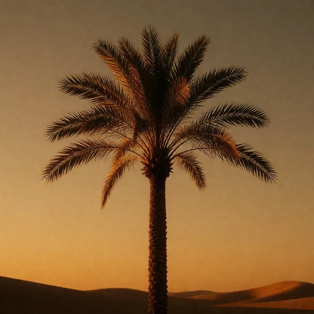
The Palm Marker — Indicator of Water and Shade
Visual Signature
The Palm Element
The iconic silhouette of the palm tree is a constant presence in every Egyptian landscape, from the coastal resorts to the deepest desert springs. These trees are not just visual markers; they are vital to the local economy and ecology.
On this site, we celebrate the palm as a symbol of life and resilience in the sun-drenched environment. Look for these icons throughout our guides as indicators of water and shade. Date palms line the Nile banks, cluster around oasis springs, and fringe the Red Sea shore. Their root systems reach deep for groundwater, and their canopy provides the only natural shade in many open landscapes. A cluster of palms on the horizon is a reliable sign that a water source is nearby.
Portal Directory
Where to Go Next
Guide 01
Coastal Retreats
Red Sea fringing reefs, quiet bays, and marine migration notes for the eastern shoreline.
Guide 02
Desert Oasis Routes
Western interior formations, caravan history, and aquifer-fed settlements.
Guide 03
Cultural Heritage Walks
Valley floor structures, materials, orientation, and urban architectural layers.
Guide 04
Nile River Vistas
Agricultural rhythms, delta marshes, and the southern cataracts from north to south.
Guide 05
Traveller Essentials
Weather zones, transit logistics, rural customs, and photography ethics for the field.
Guide 06
Regional Comparison
Side-by-side comparison of climate, terrain, and access across all covered regions.