

Nile Valley — River & Rural Landscapes
Nile River Vistas and Rural Landscapes
A thin strip of vibrant green pressed against an infinite brown desert. These egypt travelling guides follow the river as a living entity — its seasonal cycles, its farming villages, and the palms that frame every bend.
Chapter 01
The Seasonal Rhythm of the Water
The Nile Valley is a thin strip of vibrant green surrounded by an infinite brown desert. It is the lifeblood of the nation, providing water for millions and a fertile corridor for agriculture. Historically, the river's annual flood dictated the entire agricultural calendar, depositing rich silt across the floodplain and resetting the land for a new season of planting.
While the flow is now regulated by modern engineering, the rhythm of the seasons remains visible in the types of crops grown along the banks. Wheat and barley follow the cooler months; cotton, sugarcane, and maize fill the long summer heat. The river functions as a closed ecosystem — what happens upstream affects every village downstream, from sediment loads to salinity levels.
For any traveller into Egypt, understanding the hydrology of the Nile is fundamental to understanding the country itself. The challenges the river faces from climate change, upstream pressures, and pollution are not abstract concerns — they shape the daily reality of the farming communities that line its banks.
Chapter 02
Traditional Agriculture and Feluccas
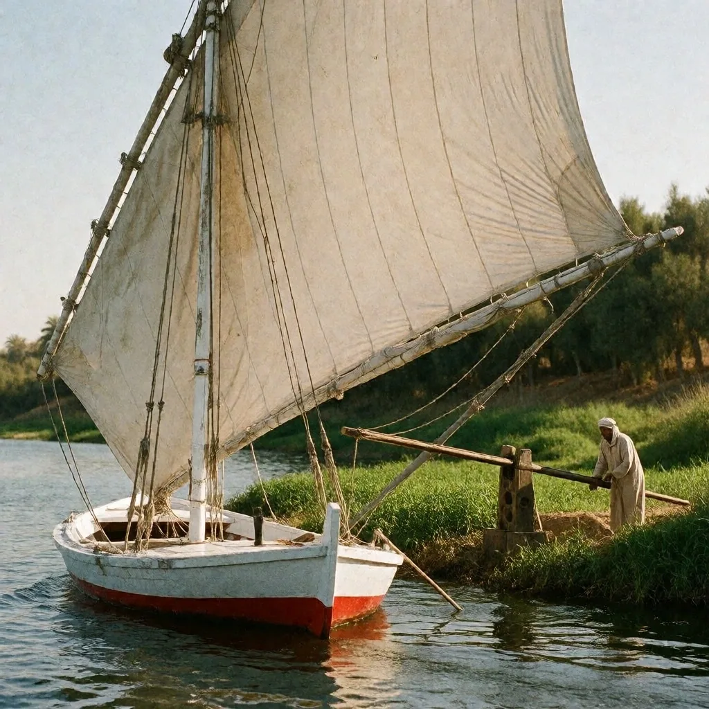
On the banks of the river, farming techniques have remained largely unchanged for generations. The shaduf — a simple counterweighted lever used to lift water from the canal to the field — and the wooden waterwheel can still be seen in some rural areas, operated by hand as they have been for centuries.
The felucca is the other enduring fixture of the river landscape. These traditional wooden sailing boats have navigated the Nile for centuries, relying on a single lateen sail and the prevailing wind. They move quietly, without engine noise, and offer one of the most peaceful ways to experience the water — the sort of slow observation that our travel guides encourage.
The boatmen read the current and the wind the way a farmer reads the sky. A few hours on a felucca reveals the river's texture: the shift between open water and reedy shallows, the calls of birds lifting from the bank, the silhouette of palms sliding past against the desert backdrop.
Chapter 03
The Flora of the Riverbanks
The Nile supports a wide variety of plant life that stands in sharp contrast to the surrounding desert. From the towering date palms that mark every village to the papyrus reeds clustered in the marshier sections, the greenery is dense and productive. This botanical diversity is a key part of the valley's charm — the line between lush corridor and arid plateau is often only a few hundred meters wide.
Riverbank Flora — Common Species Field Notes
Date Palm
Phoenix dactylifera
The vertical signature of the valley. Tall single trunks and heavy frond crowns line every irrigation canal and village edge, providing summer shade and October fruit.
Papyrus Reed
Cyperus papyrus
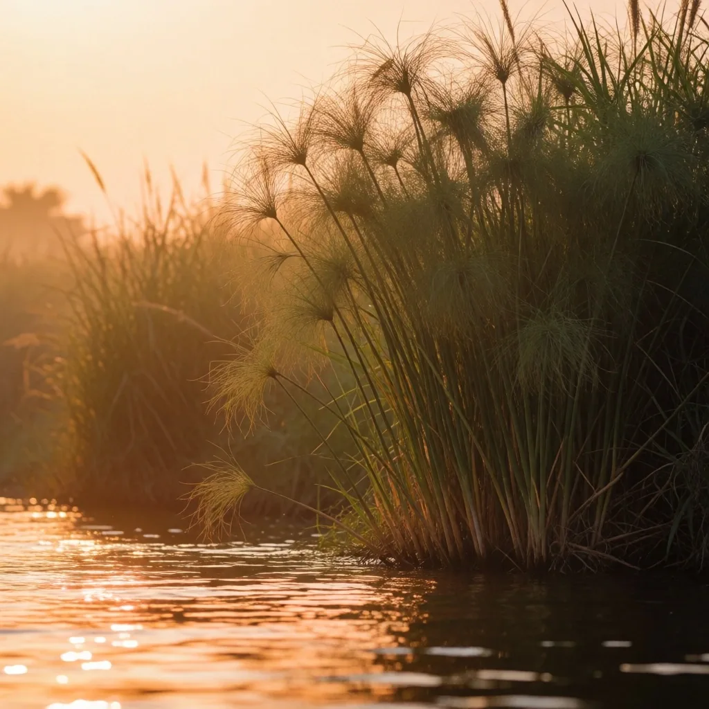
Found in the marshier sections and slow channels. Triangular green stems topped by feathery umbels, forming dense stands that shelter small birds and fish.
Mimosa
Acacia nilotica
A fragrant thorn tree that tolerates poor soil and canal edges. Yellow puffball flowers appear in the warm months, drawing bees and butterflies across the bank.
Sycamore Fig
Ficus sycomorus
A hardy, wide-crowned shade tree common near village wells and riverfront courtyards. Broad leaves and small clustered figs make it a gathering point in rural communities.
Chapter 04
Birdlife and Migratory Paths
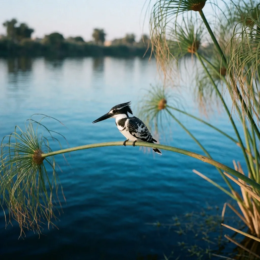
The river corridor is a major highway for birds migrating between Europe and Africa. During the spring and autumn passages, the sky and the reeds are filled with herons, egrets, and kingfishers — species that follow the waterline because it offers food and cover across otherwise dry terrain.
Early morning is the most reliable observation window, when the river is still and the birds are feeding at the bank edge. Quiet footpaths along canal bunds offer the best vantage points; binoculars and patience matter more than distance. The Nile is a genuine paradise for those interested in ornithology, and our egypt travelling guides note the seasonal timing of these migrations so you know when to plan a visit.
Chapter 05
The Cataracts and Granite Islands
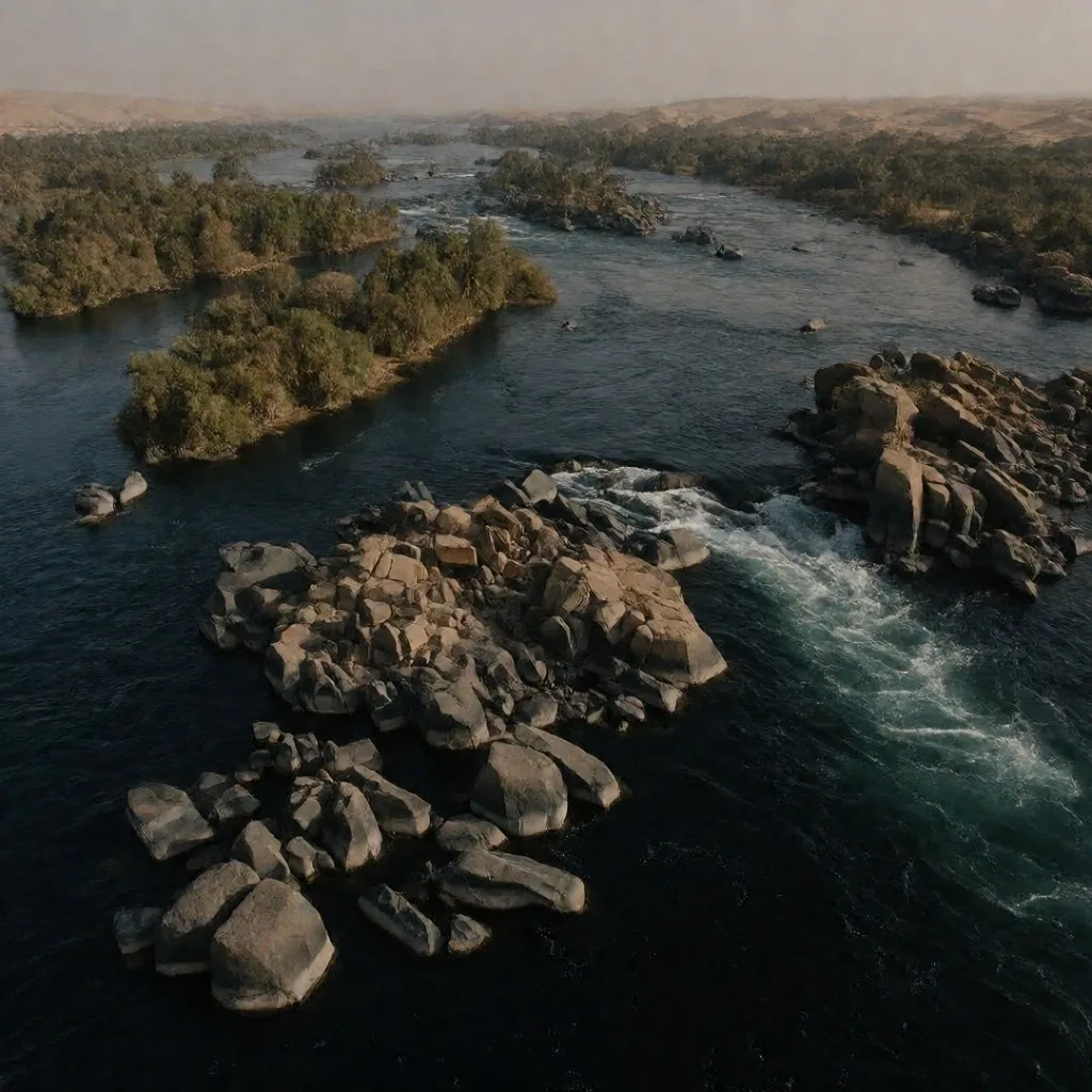
In the south, the river is interrupted by granite barriers known as cataracts. These areas are characterized by fast-flowing water and dozens of small, rocky islands. The geography here is more rugged and dramatic than the flat plains of the north — boulder-strewn channels, sudden drops in the riverbed, and a shoreline that shifts with the water level.
The islands of the First Cataract are home to unique flora adapted to shallow soil and spray, and a different cultural atmosphere — Nubian villages with bright painted doorways, palm groves tucked between granite outcrops, and footpaths that connect islets by shallow fords. The contrast between the controlled, engineered river in the north and this rugged southern stretch is a major theme of our travel guides.
First Cataract — Southern Nile
Chapter 06
Village Life and River Culture
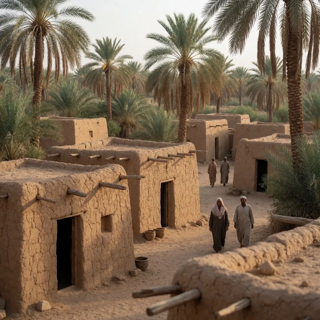
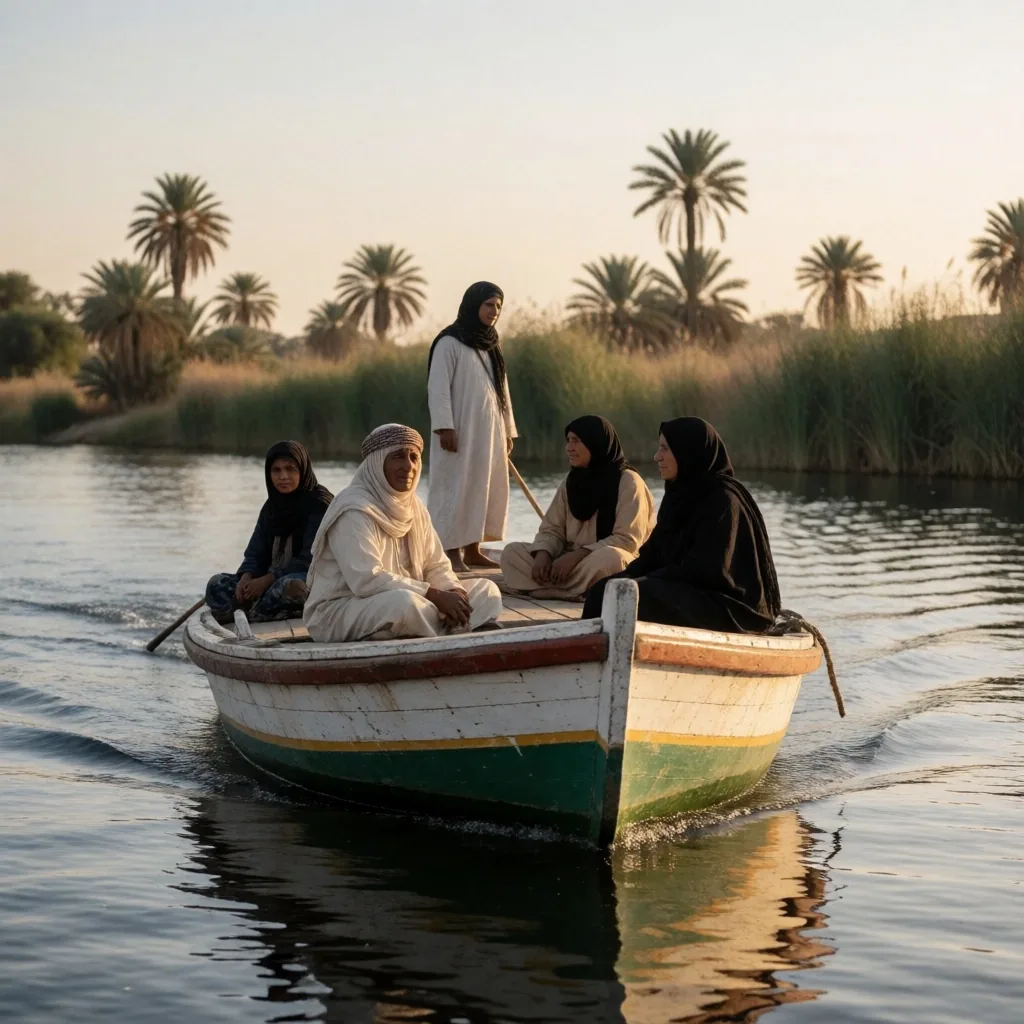
The communities along the Nile have a deep connection to the water. The architecture of the villages often reflects the local materials, with houses built from the silt of the river — dried into bricks that hold the cool of the night through the heat of the day. Courtyards face the water, and the social life of these riverfront towns moves with the rhythm of the ferry.
Where bridges are far apart, the ferry is often the main form of transport, carrying farmers, schoolchildren, and merchants between banks. Understanding the culture of the river is essential for any traveller into Egypt moving beyond the major cities — the pace is slower, the hospitality is direct, and the river is never out of view.
Chapter 07
The Delta and the Branches
In the north, the Nile splits into the Rosetta and Damietta branches, creating a vast triangular plain of fertile land. This region is the agricultural heart of the country, producing everything from cotton to citrus fruits across a dense network of canals and drainage channels.
The landscape here is flat, green, and densely populated — a patchwork of small fields, tree-lined bunds, and compact villages connected by narrow roads. The proximity to the Mediterranean brings cooler, damper air, and the air carries the scent of rich alluvial soil and citrus blossom in season. The Delta is where the river finally spreads out before meeting the sea.
Delta Reference
Rosetta Branch
The western distributary, reaching the Mediterranean at the port town of Rashid. Wider and slower than the southern channel.
Damietta Branch
The eastern distributary, winding through rich farmland to the coast. Lined with fishing boats and palm-fringed banks.
Canal Network
A dense web of irrigation channels feeding smallholdings — the working circulatory system of the Delta plain.
Chapter 08
River Safety and Navigation
For those interested in exploring the water, it is important to understand the currents and the rules of the river. While the Nile is generally calm in its middle and lower stretches, the movement of large vessels, the presence of submerged rocks in the southern cataracts, and the shifting of sandbanks all require caution.
If you are using local transport or small boats, agree on the route and the return time before departing, and avoid night crossings outside lit ferry points. The river is a shared resource — fishing nets, irrigation intakes, and swimming children all occupy the same narrow corridor. Navigating it requires respect for other users and a willingness to wait when the wind or the current is not favorable.
Before Boarding
Confirm the boat operator knows the route, the landing point, and the agreed return time. Life vests should be available for each passenger.
On the Water
Keep hands inside the boat near reeds and mooring lines. Watch for submerged rocks in the southern channels and give large vessels a wide berth.
Shared Corridor
Slow down near fishing nets and swimming areas. The river is a working waterway — patience and a quiet approach are expected.
Chapter 09
The Impact of the High Dam
The landscape of the southern Nile was permanently altered by the construction of the Aswan High Dam. This engineering project created a massive reservoir that stretches far into Sudan, submerging the former riverbank and replacing the seasonal flood with a controlled release schedule.
The consequences were wide-ranging. The annual silt deposit that fertilized the floodplain is now trapped behind the dam, forcing farmers downstream to rely on chemical fertilizers. Coastal erosion increased in the Delta because the sediment that once reached the sea was cut off. Ancient monuments in the path of the rising reservoir were relocated block by block to higher ground — an international effort that saved the structures but severed them from their original settings.
The contrast between the controlled river in the north and the vast lake in the south is a major theme of our travel guides. Standing on the shore of the reservoir, you see a body of water that did not exist a century ago, filling a desert landscape to the horizon.
Before & After the Dam
Before
Annual flood deposited fertile silt across the valley. Cataracts defined the southern river. Villages farmed the receding floodplain.
After
Controlled release replaced the flood. Reservoir flooded the former valley. Downstream farming shifted to year-round irrigation with chemical inputs.
Chapter 10
Sunset and the Golden Hour
The Nile is famous for the quality of its light, especially at dawn and dusk. The reflection of the low sun on the water and the silhouette of the palms against the desert hills create an atmosphere that has drawn travellers and artists for centuries. The visual beauty of the river is a constant source of inspiration for visitors and locals alike.
For the best vantage points, look for west-facing bends in the river where the water opens up and the palm line is backed by rising ground. A felucca at anchor, or a quiet bank at the edge of a village, offers the simplest framing. Arrive thirty minutes before the sun touches the horizon — the richest color comes in the last ten minutes, when the sky goes from amber to deep rose and the water holds the afterglow.
Continue Reading
More egypt travelling guides for the independent traveller
Coastal Guide
Coastal Retreats Guide
Red Sea shoreline, coral reefs, and quiet anchorages away from the resort strips.
Desert Guide
Desert Oasis Routes
Springs, dune crossings, and the geology that frames the valley on either side.
Heritage Guide
Cultural Heritage Walks
Stone temples and old quarters that line the river from Aswan to the Delta.
Questions About the Nile?
Reach our editorial team in Zamalek
We are a small editorial desk based in Cairo, compiling field notes for independent travellers. If you have a question about river routes, seasonal timing, or local transport along the Nile, write to us — we answer every message.
Address
36FC+4MF, Mohammed Mazhar, Abu Al Feda, Zamalek, Cairo Governorate 11211, Egypt
Phone
+20 121 112 1808Hours
Monday to Sunday, 08:00 – 20:00